|
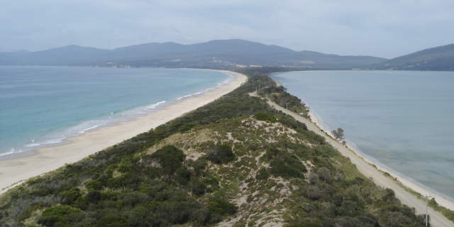
The Neck that divides Bruny Island in half, seen from the Penguin
Observatory steps. Note the 'beachiness' on the left (sea) side and
the more abrupt waterline on the right (sound or channel or mainland)
side. This tendency continues over most of the island, though
paradoxically some of the highest cliffs of any Australian coast
are on the Bruny sea side. They're of dolerite, as usual.
The island is named for Bruni d'Entrecasteaux, an early French explorer
with florid spelling habits. The channel to the right bears his last
name and hardly bears repeating.
Remember the lady who helped us out on the way to the Botanical
Gardens? Apparently her Great^N Grandfather owned the north half some
time in the past. Sheep and whaling station. As she tells it, he
rowed all the way from Dennes Point to Kangaroo Point (I figure that
at about ten miles) to court his sweetie. It apparently worked
fine as she's Great^N Grandma.
But she didn't tell us that on the bus to the gardens.
|
